18
Features
You can use the menu bar to perform various tasks from the main program
window. The following sections describe how to use the GPS PC Companion menu
items. You can also use the toolbar icons to carry out various functions. Move your
mouse over the toolbar icons to view a tool-tip about the icon and learn what each
icon represents.
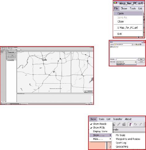
File Menu
Click File | Open to open map card les (*.ard) or map list les
(*.arl, which contains a list of several map card les).
Select a map list le (*.arl) from the File Open menu and click
OK.
The selected map le opens and the roads and points of
interests are displayed on the map.
Show Menu
Click Show and choose the item that you want to
display on the map. Move the cursor over the map
and hold it over a road or any other point of interest
to view information about the location. The exact
latitude, longitude, name of the road, district, and
name (if any) of the location are displayed next to
the cursor.
Use the following items on the Show menu as follows:
Show Roads – displays all roads on the map.
Show POIs – displays points of interest on the map.
Show POIs Name – displays the names of the points of interest
Display Icons – enables you to choose which points of interests are displayed
on the map. You can select various types of locations (see list below) to be
displayed on the map by selecting the required check boxes.
Show/Hide | My Trails – displays or hides details of a trail log (*.trl).
Show/Hide | Waypoints and Routes – displays or hides routes (*.wpr) created
from waypoints on the map.