


CONFIGURE SPAN-CPT USING THE COMMAND LINE
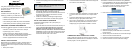
MEASURE THE LEVER ARM
Enter the distance from the IMU to the GNSS antenna using the
SETIMUTOANTOFFSET command. The offset between the
antenna phase centre and the IMU axes must remain constant
and be known accurately (m). The X (pitch), Y (roll) and Z
(azimuth) directions are clearly marked on the IMU enclosure.
The SETIMUTOANTOFFSET parameters are (where the
standard deviation fields are optional):
x_offset y_offset z_offset [x_stdev] [y_stdev] [z_stdev]
For the integrated INS/GNSS system to have the best level of
accuracy, the offset should be measured to within a millimetre.
Any error in this measurement will show up in the output
position. For example, a 10 cm error in measuring this offset will
result in at least a 10 cm error in the output. If the system is
installed in line with the vehicle, this is the only configuration
required.
LOG SPAN-CPT DATA
Raw GNSS, IMU and navigation data (position, velocity, attitude)
are available from the system as ASCII or binary logs.
Data can be collected through Connect using the Logging
Control window, or sent out the IMU COM port to user-supplied
data collection software.
For post-processing applications, collect the data shown in the
Data for post-processing section in this guide.
For real-time applications, the GNSS/INS solution is available
through the logs listed in the SPAN-CPT User Manual including
INSPOS, INSVEL, INSATT and INSPVA. These logs can be
collected at rates up to the IMU data rate (100 Hz); however,
there are some rate restrictions. Refer to the Data Collection
section in the SPAN Operation chapter of the SPAN-CPT User
Manual.
OPERATE THE SPAN-CPT SYSTEM
The system is ready to go once it is powered and the INS and
GNSS are configured using the previously shown commands.
Observe the status of the system in the INS window of NovAtel
Connect or in the status field of any of the INS solution logs (for
example INSPOS, INSVEL, INSATT and INSPVA).
The following status stages may be observed:
• The status changes from INS_INACTIVE to INS_ALIGNING
once the receiver computes a GPS solution.
• The default alignment method for CPT is a kinematic align-
ment. The INS solution will begin once the vehicle starts to
move faster than 1.15 m/s. Alternatively, you can set the atti-
tude of the system manually by using the SETINTAZIMUTH
command. See the SPAN-CPT User Manual for more details
on how to use this command.
• The status changes to INS_ALIGNMENT_COMPLETE
when alignment is completed. After some motion (stops,
starts and turns), the attitude solution converges to within
specifications, and the status changes to
INS_SOLUTION_GOOD.
• The status may occasionally change to
INS_BAD_GPS_AGREEMENT. This status indicates that
the inertial solution has detected poor quality GNSS
positions from the receiver due to limited satellite visibility or
high multipath conditions. The inertial filter may choose to
disregard this information and wait for the GNSS quality to
improve. The solution is still valid during these times, it is
simply a warning flag that the GNSS/INS solution is more
reliable than the GNSS-only solution.
DATA FOR POST-PROCESSING
Post-processing requires collection of simultaneous data from
the base and rover stations. This includes accurate coordinates
of the base station and accurate measurement of the IMU to
antenna separation.
Collect the following data for post-processing:
• From the base station
• RANGECMPB ontime 1
• RAWEPHEMB onnew
• From the rover station(s)
• RANGECMPB ontime 1
• RAWEPHEMB onnew
• RAWIMUSB onnew
• BESTLEVERARMB onnew
SPAN-CPT system output is compatible with Inertial Explorer
post-processing software from the Waypoint Products Group,
NovAtel Inc. Visit our website at www.novatel.com
for details.
Questions or Comments
If you have any questions or comments regarding your SPAN-CPT
system, please contact NovAtel Customer Service by:
Email: support@novatel.com
Web: www.novatel.com
Phone: 1-800-NOVATEL (U.S. & Canada)
1-800-668-2835
1-403-295-4900 (International)
Fax: 1-403-295-4901
INS data is available once there is a good GNSS solution.
Therefore, an antenna must be connected for the system to
function.
NovAtel, SPAN, Inertial Explorer, Waypoint and OEMV are registered trademarks of
NovAtel Inc.
SPAN-CPT is a trademark of NovAtel Inc.
Windows is a registered trademark of Microsoft Corporation.
© Copyright 2012 NovAtel Inc. All rights reserved.
Printed in Canada on recycled paper. Recyclable.
Unpublished rights reserved under international copyright laws.