


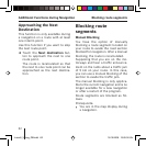

70
Product Information
Touch this fi eld to display the ver-
sion of the map being used and
the version of the navigation soft-
ware.
➜
GPS Mode of Operation
The Global Positioning System (GPS)
was developed in the 70s by the US
military.
GPS is based on a total of 24 satel-
lites that are orbiting the earth and
sending out signals. The GPS receiver
receives these signals and calculates
its distance to the individual satel-
lites using the propagation time of
the signals. This information is then
used to determine its current geo-
graphical position.
The positioning requires signals from
at least three satellites, and starting
with the fourth one it is also possible
to determine the altitude above sea
level. The positioning is carried out
with an accuracy to 3 metres.
Navigation with GPS. The provided
maps also contain the geographical
coordinates of the displayed points
of interest, streets and towns. This
allows the navigation system to cal-
culate a route from a starting point to
a place of destination.
Confi guring Lucca GPS Mode of Operation
Lucca3_3_long_GB.indd 70Lucca3_3_long_GB.indd 70 18.10.2006 15:05:31 Uhr18.10.2006 15:05:31 Uhr