Page 8 of 18
More information . . .
?
For more information on setting up your display refer to:
Chapter 4 - Using the Chartplotter of the C-Series Reference Manual
D6727-2
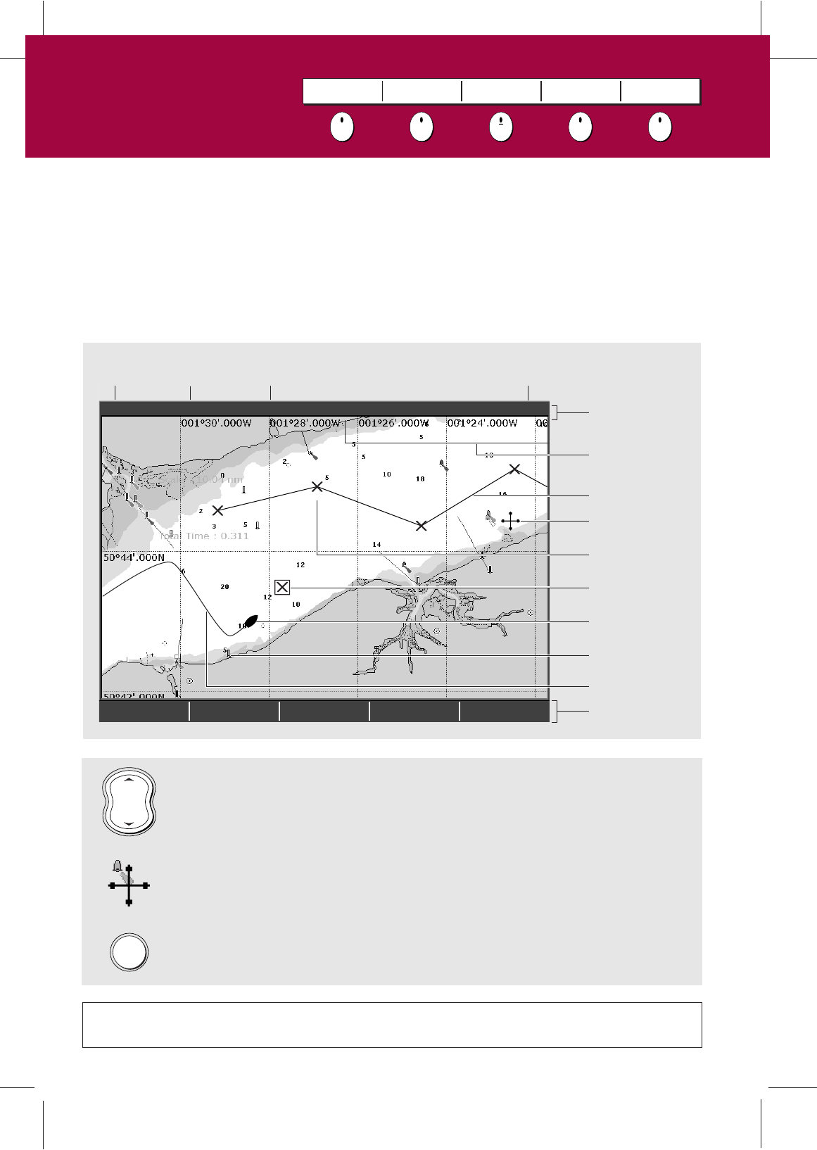
FIND SHIP GOTO… ROUTES… TRACKS… PRESENTATION…
4nm North-Up (Relative Motion) Local
Gully Ridge
Creek point
Port point
Portside
To display additional information on a cartographic feature - move the cursor
over the object and press OK.
To change the level of cartographic detail displayed on your chart - press MENU,
select Cartography Setup and then toggle the appropriate feature to ON or OFF.
The chart shows a high level of cartographic detail to help:
- Interpret your surroundings.
- Navigate to a specific point.
- Monitor where you are going.
- Record where you have been.
- Build and follow routes.
What does the chart show me?
MENU
RANGE
IN
OUT
Chart
range
Chart
orientation
Motion
mode
Chart
view
Chart boundary
Status bar
Cursor
Route
Waypoint
Current position
Track
Cartographic object
Active waypoint
Soft keys
To change the scale and reveal more detail - use the RANGE button.
Press OUT to see a larger area of the chart and press IN to see a smaller area.
What can I see?
Understanding the chart
Card No. 6
FIND SHIP GOTO ROUTES TRACKS PRESENTATION