


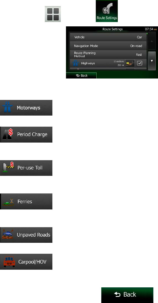
3.4.8 Changing the road types used in route planning
To recalculate the active route with different road type preferences, do as follows. These changes can
also be made in Settings (page 93).
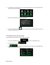
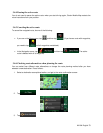
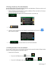
1. On the Map screen, tap
and then tap .
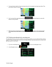
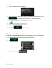
2. Tap any of the listed road types to modify the route. If needed, scroll the list for all road types. You
have the following options (their order depends on the selected vehicle type):
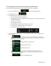
•
- You might need to avoid freeways when you are driving a slow car or
you are towing another vehicle.
•
- Charge roads are pay roads where you can purchase a pass or
vignette to use the road for a longer period of time. They can be enabled or disabled
separately from toll roads.
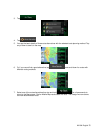
•
- Clarion Mobile Map includes toll roads (pay roads where there is a
per-use charge) in the routes by default. If you disable toll roads, Clarion Mobile Map plans
the best toll-free route.
•
- Clarion Mobile Map includes ferries in a planned route by default.
However, a map does not necessarily contain information about the accessibility of
temporary ferries. You might also need to pay a fare on ferries.
•
- Clarion Mobile Map excludes unpaved roads by default: unpaved
roads can be in a bad condition and usually you cannot reach the speed limit on them.
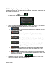
•
- Carpool or HOV lanes can be used if a given number of passengers
are traveling in the vehicle. You should check whether you are allowed to use carpool lanes
before enabling this road type.
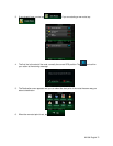
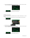
3. The route has already been recalculated. Tap
to return to the Map screen.
The orange line now shows the new recommended route.
76 NX404 English