


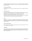
Show or suppress the 3D elevation of the surrounding terrain.
Turn on or off track log saving, that is, saving the sequence of the locations your
journeys go through.
Select which Places to show on the map while navigating. Too many Places make
the map crowded so it is a good idea too keep as few of them on the map as
possible. For this, you have the possibility to save different Place vi
sibility sets. You
have the following possibilities:
• Tap the checkbox to show or hide the Place category.
• Tap the name of the Place category to open the list of its subcategories.
• Tap to save the current Place visibility set or to load a
previously saved one. Here you can also revert to the default visibility
settings.
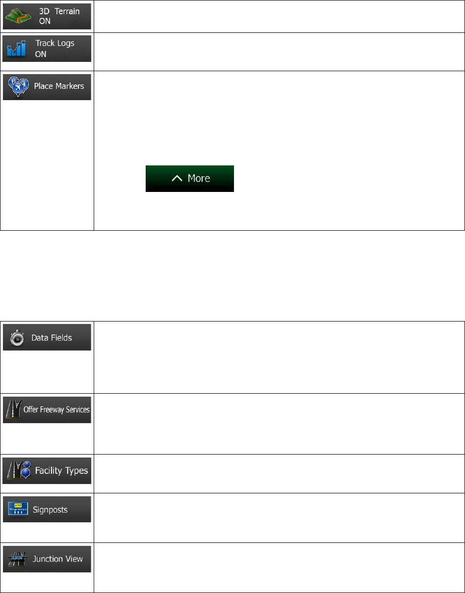
5.3.6 Visual guidance settings
Adjust how the software helps you navigate with different kinds of route related information on the Map
screen.
The data fields in the corner of the Map screen can be customiz
ed. Tap this button
and select the value
s you want to see. The values can be different when you
navigate a route from when you are just cruising without a given destination. You
can select general trip data like your current speed or the altitude, or route data
related to your final destination or the next waypoint on your route.
You may need a gas
station or a restaurant during your journey. This feature
displays a new button on the map when you are driving on freeway
s. Tap this button
to open a panel with the details of the next few exits or service stations. Tap any of
them to display it on the map and add it as a waypoint to your route if needed.
Select the service types displayed for the freeway
exists. Choose from the POI
categories.
When
ever adequate information is available, lane information similar to the real
ones on road signs above the road is displayed at the top of the map. You can turn
this feature on or off.
If you are approaching a freeway
exit or a complex intersection and the needed
information exists, the map is replaced with a 3D view of the junction. You can turn
this feature on or let the map be displayed for the whole route.
98 NX404 English