


Garmin GPSMAP 695/696 Owner’s Manual
190-00919-00 Rev. F
57
GPS Navigation
Overview GPS Navigation Flight Planning Hazard Avoidance Additional Features Appendices Index
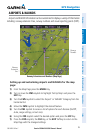
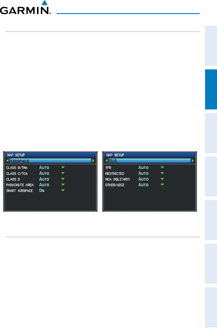
AIRSPACE
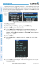
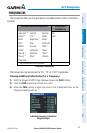
Setting up and customizing airspace for the map page:
1)
From the Map Page press the MENU Key.
2)
Turn or move the FMS Joystick to highlight ‘Set Up Map’ and press the
ENT Key.
3)
Turn the FMS Joystick to select the ‘Airspace’ or ‘SUA’ (Special Use
Airspace) Category from the horizontal list.
4)
Move the FMS Joystick to highlight the desired feature.
5)
Turn the
FMS
Joystick to access a list of options for each feature (On/Off,
Auto, or range settings).
6)
Using the
FMS
Joystick select the desired option and press the
ENT
Key.
7)
Press the FMS Joystick, the CLR Key, or the EXIT Softkey to return to the
Map Page with the changed settings.
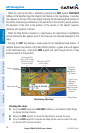
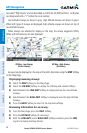
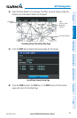
Map Setup Page (Airspace Category) Map Setup Page (SUA Category)
AIRWAYS
Low Altitude Airways (or Victor Airways) primarily serve smaller piston-engine,
propeller-driven airplanes on shorter routes and at lower altitudes. Airways are eight
nautical miles wide and start 1,200 feet above ground level (AGL) and extend up
to but not including 18,000 feet mean sea level (MSL). Low Altitude Airways are
designated with a “V” before the airway number (hence the name “Victor Airways”)
since they run primarily between VORs.
High Altitude Airways (or Jet Routes) primarily serve airliners, jets, turboprops, and
turbocharged piston aircraft operating above 18,000 feet MSL. Jet Routes start at
18,000 feet MSL and extend upward to 45,000 feet MSL (altitudes above 18,000 feet