


Garmin GPSMAP 695/696 Owner’s Manual
190-00919-00 Rev. F
74
GPS Navigation
OverviewGPS NavigationFlight PlanningHazard AvoidanceAdditional FeaturesAppendicesIndex
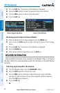
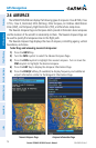
2.6 AIRSPACE
The GPSMAP 695/696 can display the following types of airspaces: Class B/TMA, Class
C/TCA, Class D, Restricted, MOA (Military), Other Airspace, Air Defense Identification
Zone (ADIZ), and Temporary Flight Restriction (TFR), and Parachute Jump Areas.
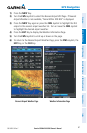
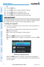
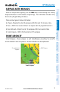
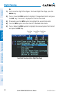
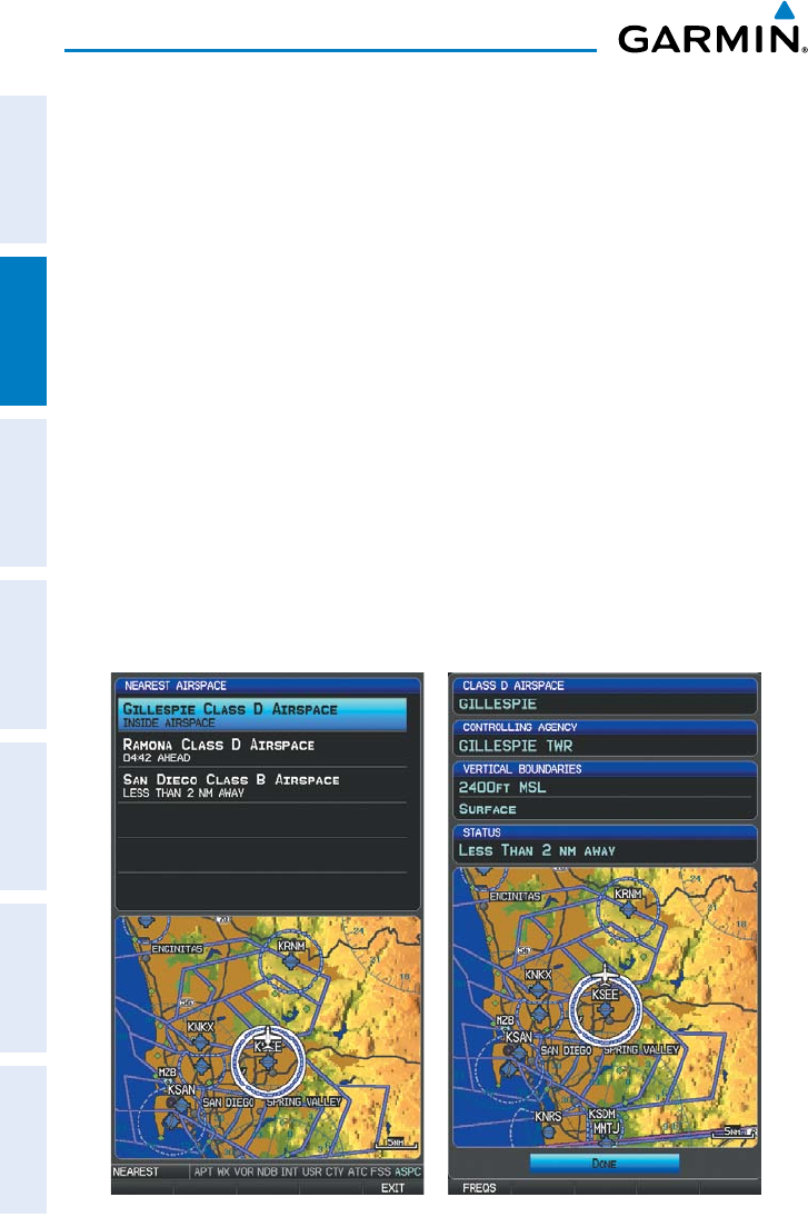
The Nearest Airspace Page and Airspace Alerts provide information about airspaces
and the location of the aircraft in relationship to them. The Nearest Airspace Page can
be used to quickly find airspaces close to the flight path.
The Nearest Airspace Page displays the class of airspace, controlling agency, vertical
boundaries, and status.
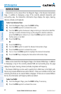
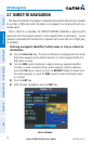
Selecting and viewing nearest airspaces:
1)
Press the NRST Key.
2)
Turn the FMS Joystick to select the Nearest Airspace Page.
3)
Press the FMS Joystick to highlight the nearest airspace. Turn or move the
FMS Joystick to highlight the desired airspace.
4)
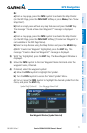
Press the ENT Key to display the Airspace Information Page.
5)
Press the FREQS Softkey (if available) to display frequency and additional
airport information similar to the Waypoint Information Page.
Nearest Airspace Page Airspace Information Page