


Garmin GPSMAP 695/696 Owner’s Manual
190-00919-00 Rev. F
58
GPS Navigation
OverviewGPS NavigationFlight PlanningHazard AvoidanceAdditional FeaturesAppendicesIndex
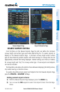
are called “flight levels” and are described as FL450 for 45,000 feet MSL). Jet Routes
are designated with a “J” before the route number.
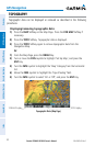
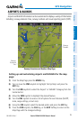
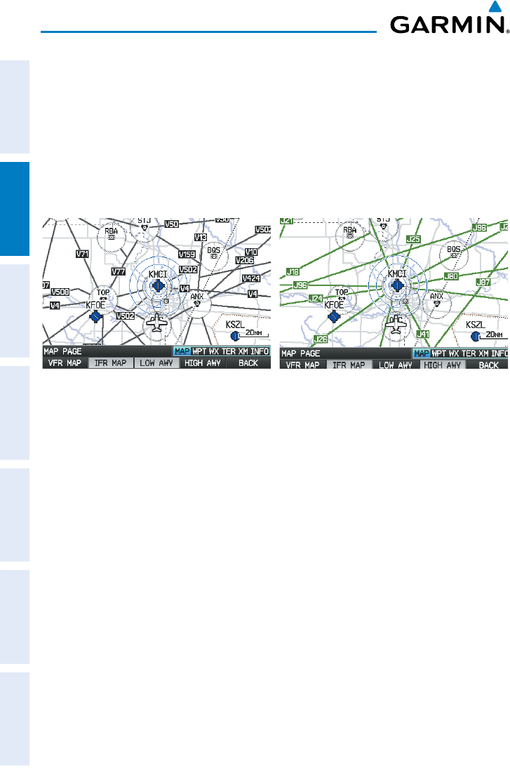
Low Altitude Airways are drawn in gray. High Altitude Airways are drawn in green.
When both types of airways are displayed, high altitude airways are drawn on top of
Low Altitude Airways.
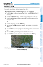
When airways are selected for display on the map, the airway waypoints (VORs,
NDBs, and Intersections) are also displayed.
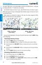
IFR Map - Low Airways
(Victor Airways)
IFR Map - High Airways
(Jet Routes)
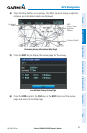
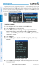
Airways may be displayed on the map at the pilot’s discretion using the MAP Softkey
on the Map Page.
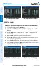
Displaying/removing airways:
1)
Select the MAP Softkey on the Map Page.
2)
Select the IFR MAP Softkey to display the IFR Map and related softkeys.
3)
Select/deselect the LOW AWY Softkey to display/remove the Low Altitude
Airways.
4)
Select/deselect the HIGH AWY Softkey to display/remove the High Altitude
Airways.
5)
Press the BACK Softkey to return to the top-level softkeys.
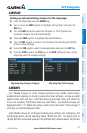
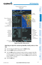
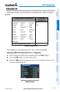
Reviewing information for an airway:
1)
From the Map Page, press the MAP Softkey.
2)
Press the IFR MAP Softkey (if necessary).
3)
With the LOW AWY and/or HIGH AWY Softkeys selected, press the FMS
Joystick to display the Map Pointer.