


Garmin GPSMAP 695/696 Owner’s Manual
190-00919-00 Rev. F
51
GPS Navigation
Overview GPS Navigation Flight Planning Hazard Avoidance Additional Features Appendices Index
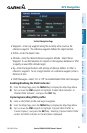
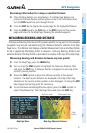
Reviewing information for a map or weather feature:
1)
Place the Map Pointer on a map feature. If multiple map features are
present at the Map Pointer position (green arrow in the information box),
turn the FMS Joystick to cycle through the list.
2)
Press the ENT Key to display the review page for the highlighted feature.
3)
Press the FMS Joystick, the CLR Key, or the ENT Key to exit the review
page and return to the Map Page showing the selected waypoint.
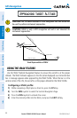
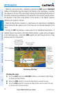
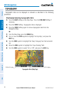
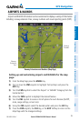
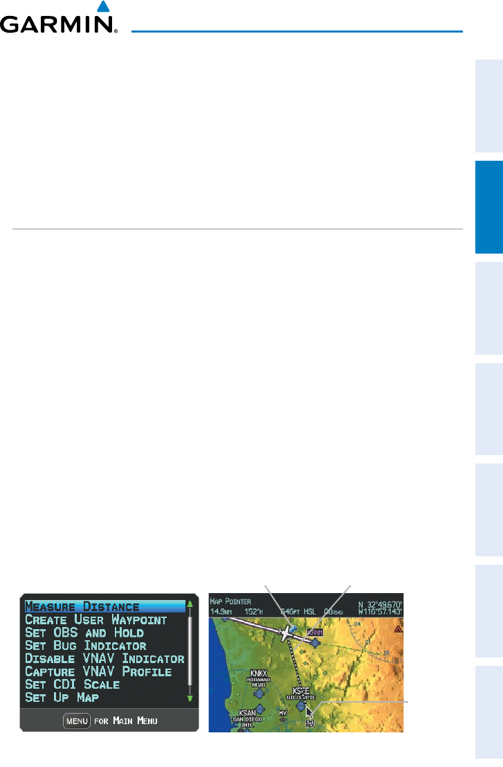
MEASURING BEARING AND DISTANCE
Distance and bearing from the aircraft’s present position to any point on the viewable
navigation map may be calculated using the ‘Measure Distance’ selection from Map
Page menu. The distance tool displays a dashed Measurement Line and a Map Pointer
to aid in graphically identifying points to measure. Lat/Long, bearing, distance and
elevation data for the Map Pointer is provided in a window at the top of the Map Page.
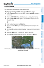
Measuring bearing and distance between any two points:
1)
From the Map Page, press the MENU Key.
2)
Turn or move the FMS Joystick to highlight the ‘Measure Distance’ field
and press the ENT Key. A Measure Pointer is displayed on the map at the
aircraft’s present position.
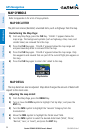
3)
Move the FMS Joystick to place the reference pointer at the desired
location. The bearing and distance are displayed at the top of the map.
Elevation at the current pointer position is also displayed. Pressing the ENT
Key changes the starting point for measuring.
4)
To exit the Measure Bearing/Distance option, press the FMS Joystick; or
select ‘Stop Measuring’ from the Page Menu and press the ENT Key.
Map Page Menu Map Page (Measure Distance)
Map
Pointer
Measurement LineReference Point