


Garmin GPSMAP 695/696 Owner’s Manual
190-00919-00 Rev. F
60
GPS Navigation
OverviewGPS NavigationFlight PlanningHazard AvoidanceAdditional FeaturesAppendicesIndex
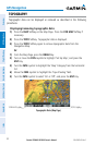
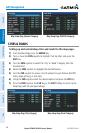
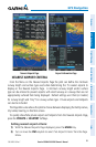
2.5 WAYPOINTS
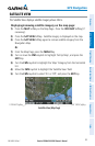
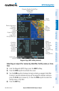
The Waypoint (WPT) Page provides airport and waypoint information.
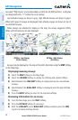
Waypoints are predetermined geographical positions (internal database) or pilot-
entered positions, and are used for all phases of flight planning and navigation.
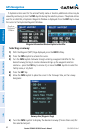
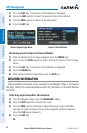
Waypoints can be selected by entering the ICAO identifier, entering the name
of the facility, or by entering the city name. As a waypoint identifier, facility name,
or location is entered, the GPSMAP 695/696’s Spell’N’Find feature scrolls through
the database, displaying those waypoints matching the characters which have been
entered up to that point. A direct-to navigation leg to the selected waypoint can be
initiated by pressing the Direct-to Key from the Waypoint Page.
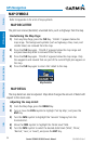
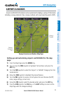
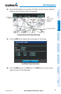
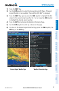
The Waypoint Page allows the pilot to review airport information, runway
information, frequencies, instrument procedures, Airport Directory information, and
weather information. The pilot can manually enter the identifier or the GPSMAP
695/696 will choose the most appropriate identifier based on the current position
and phase of flight.
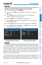
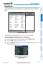
The following descriptions and abbreviations are used:
•Usagetype:Public,Military,orPrivate
•Runwaysurfacetype:Hard,Turf,Sealed,Gravel,Dirt,Soft,Unknown,orWater
•Runwaylightingtype:NoLights,PartTime,FullTime,Unknown,orPCLFreq(for
pilot-controlled lighting)
•COMAvailability:TX(transmitonly),RX(receiveonly),PT(parttime),* (additional
information available)