


Introduction
1705A Spectrum Monitor
1-9
APPLICATIONS
The principal application for the TEKTRONIX 1705A Spectrum Monitor is to
provide a convenient method to locate and identify Ku-Band satellites, find the
correct transponder and check on its availability, and optimize antenna position-
ing and polarization. The remainder of this section provides basic satellite
communications application data. Specific operating instructions are located in
Section 2, Operating Instructions.
The communications satellites that the television industry is interested in lie in a
band directly over the earth’s equator, at a distance of approximately 35,900 km
(or about 3.7 times the earth’s diameter). Traveling at approximately
11,000 km/h the satellite completes one full orbit in 23 hours, 56 minutes,
4.9 seconds, which is referred to as a sidereal day. When a satellite completes
one orbit in a sidereal day it is geographically stationary (geostationary) to a
point on the earth’s surface. Without being geostationary, using a satellite would
be extremely complicated and the calculations required to determine when they
were in the usable window, and how long they would stay there would, in most
cases, require a computer.
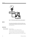
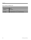
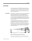
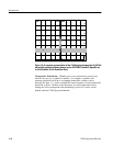
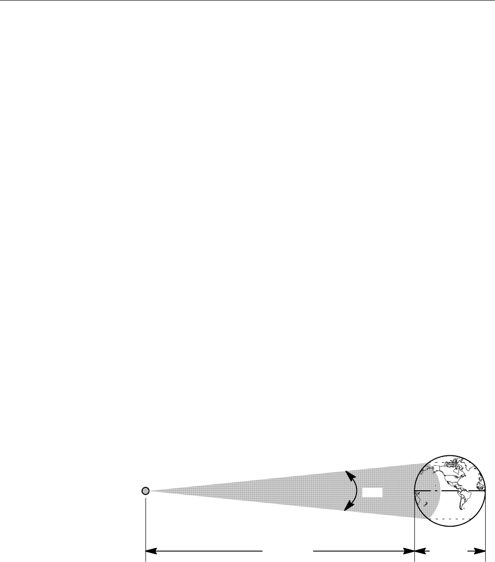
At 35,900 km distance the earth subtends an angle of 18˚, which provides
coverage of approximately 40% of the earth’s surface. See Figure 1-2. Forty
percent (40%) of the earth’s surface corresponds to an area stretching from 70˚
North latitude to 70˚ South latitude. For rough assumptions, a satellite, in
geostationary orbit over the equator, could cover latitudes from the Arctic circle
(66˚ 30’ N) to the Antarctic circle (66˚ 30’ S). However it should be noted that
even though the satellite is capable of covering 40% of the earth’s surface the
actual coverage will be less in most cases because of the antenna design and
available transmitter power.
9,675 km
35,900 km
18°
70° N
70° S
Figure 1-2: Relationship of a communications satellite to earth
Determining the exact angle from the horizon to a satellite (other than at the
equator) requires a knowledge of trigonometry, because of the relatively close
Locating Satellites